|
18th century
background |
|

Kingston, described by Edward Long in 1774, in
The History of Jamaica, Book II, Chapter VIII
|
. . . . this town was founded in the year 1693, on the North side of the harbour, which, next to Port Royal, appeared the most convenient part for trade. The plan of it was drawn by colonel Lilly, an experienced engineer, and in propriety of design it is, perhaps, not excelled by any town in the world. The plan is a parallelogram, one mile in length by half a mile in breadth, regularly traversed by streets and lanes alternately crossing each other at right angles, except in the upper part of the town, where a large square is left. But the buildings have increased so rapidly, that it now extends beyond the outlines of the plan. It contains sixteen hundred and sixty-five houses, besides Negroe houses, and warehouses; so that the whole number of its buildings, including every fort, may be computed at between two and three thousand: the number of its white inhabitants, about five thousand; of free Negroes and Mulattoes, about twelve hundred; and of slaves, about five thousand: making in the whole about eleven thousand and upwards: thirty five spacious streets; and sixteen lanes. The harbour is formed by an inlet of the sea, which, after passing Port Royal, divides into two branches; the Western, flowing to Passage Fort and the mouth of Rio Cobre, forms a small bay of shallow water; the Eastern branch runs beyond Kingston to Rock Fort, making a course this way of nine miles in length, and is two miles in width in the broadest part; facing which the town is situated. For a considerable way above and below the town, the channel is deep enough to admit ships of the greatest burthen; upwards of a thousand sail may anchor here in perfect safety, except from a hurricane; and the water is so deep at the wharfs, that vessels of two hundred ton lye along-side of them, to deliver their cargoes. |
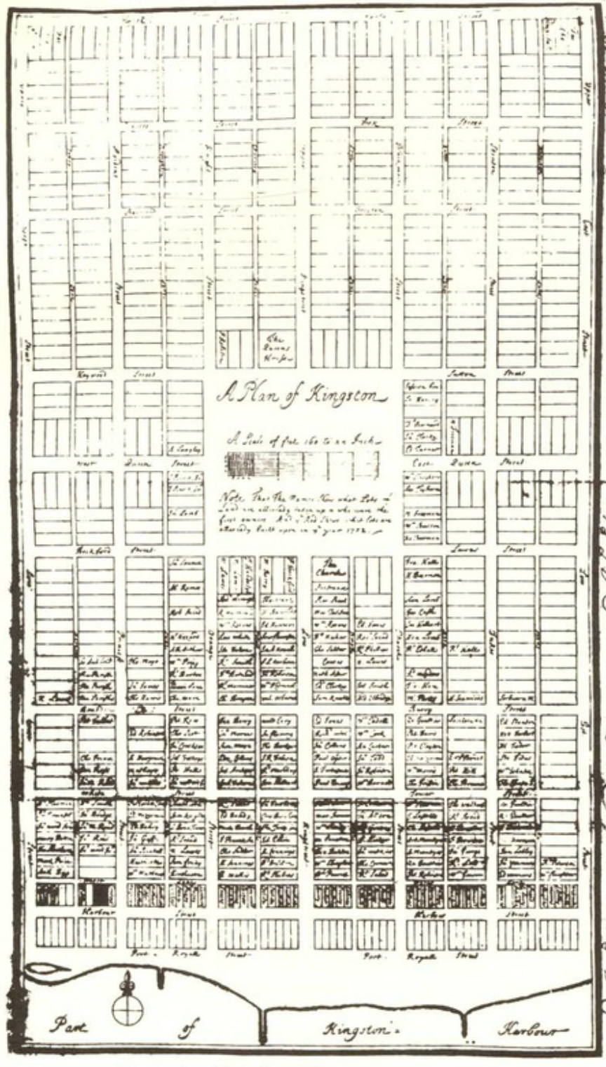
plan of Kingston by Christian Lilly, 1702